The result of torrential rain - a flooded lane in Auckland
1911 (Weekly Graphic and New Zealand Mail) - 2025
Click on image to toggle transition between two photographs
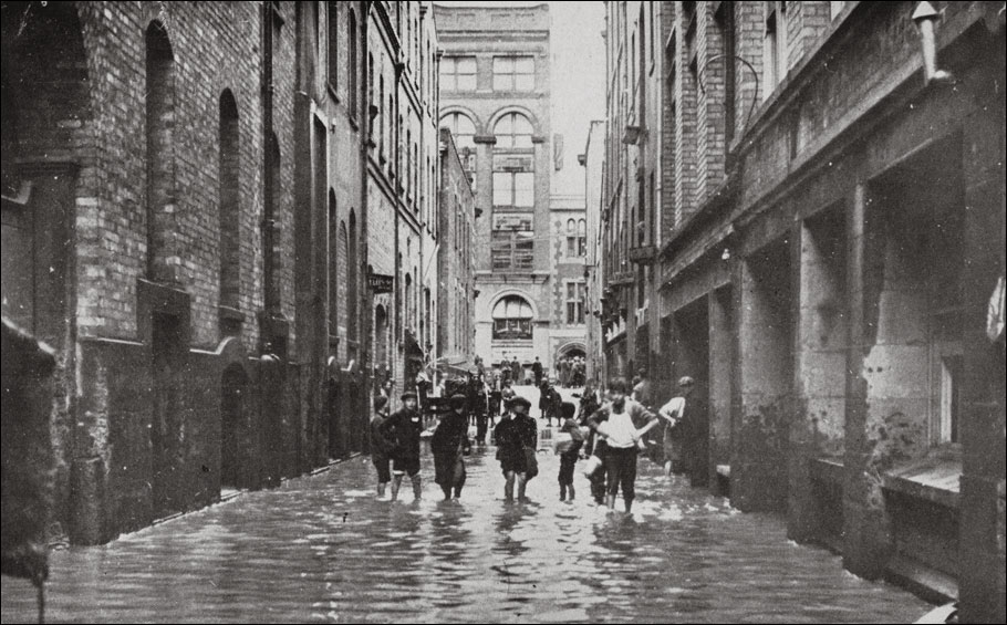
1911 image: Weekly Graphic and New Zealand Mail issue of 21 June, 1911 | Auckland Libraries Heritage Collections NZG-19110621-0019-02
Image comparison slider version
Click here for a fullscreen version of this transition
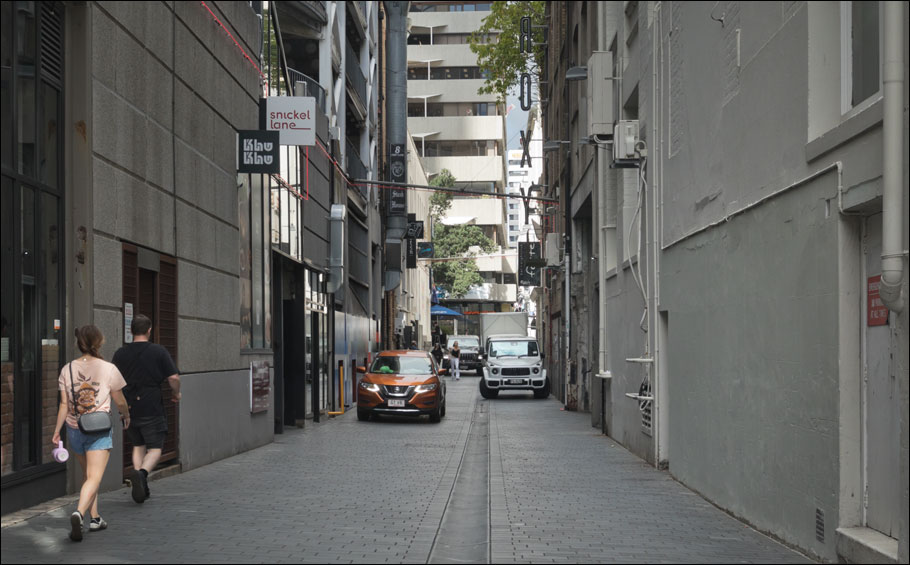
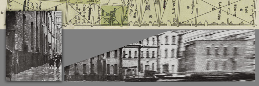
The view is looking south along Fort Lane, a service lane which runs between Customs Street and Fort Street. Below is a reconstruction of the Graphic's page, along with title and caption.
Auckland Libraries Heritage Collections NZG-19110621-0019-02 and https://paperspast.natlib.govt.nz/periodicals/new-zealand-graphic/1911/06/21/19
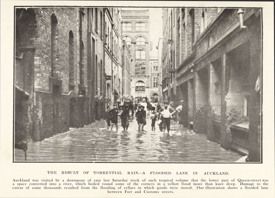
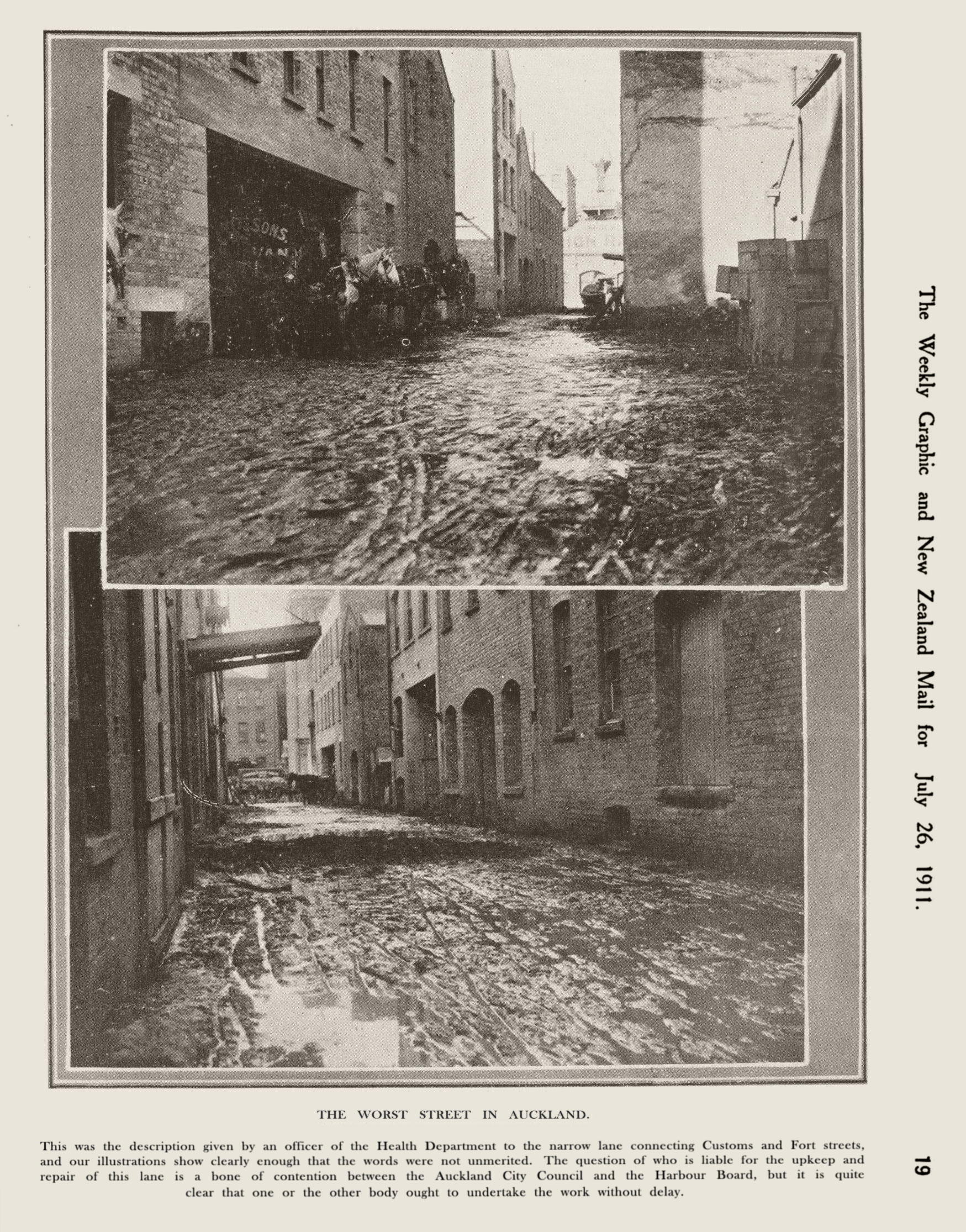
The Worst Street in Auckland
So ran the title of a caption on a full page in an issue of the Graphic published a a few weeks later (26 July 1911).
Auckland Libraries Heritage Collections NZG-19110726-0019-02 and https://paperspast.natlib.govt.nz/periodicals/new-zealand-graphic/1911/07/26/19
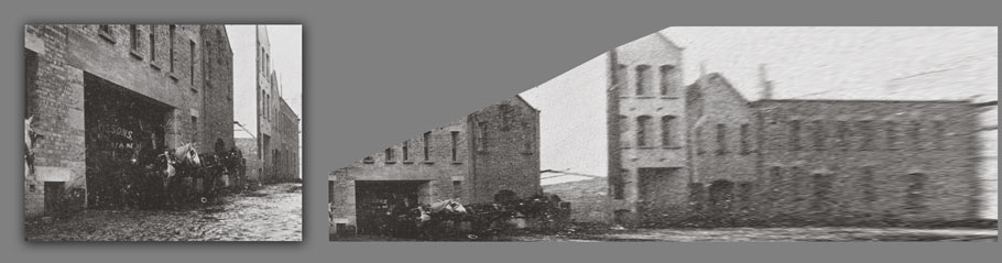
The upper image is looking toward Fort Street while the lower one is looking north toward Customs Street. These two pictures must have been older photographs that were on file at the Graphic; there are differences in details between these and the photograph showing the lane flooded at top which could hardly be accounted for in the space of the month or so between the two issues of the Graphic. The June image (of the lane flooded) shows Hobson Buildings on the far side of Fort Street at the southern end of the lane, while there is no sign of it the upper picture from the July issue. There are other differences in the details of the buildings in the lane, but the heavy foreshortening in the distance of the June image make these difficult to discern.
It is possible to "undo" the foreshortening—at least to some extent—by applying rectifying transformations to an image, but this comes at a heavy price in deteriorating image quality as distance from the camera increases. (Image quality is poor to start with in the case of these copies from issues of the Graphic as these images have a halftone screen.)
Below: at top is a part of a 1915 fire insurance plan showing the eastern side of Fort Lane (Auckland Libraries Heritage Collections Map 9128e). At left is the image used for the rectification, the left half of the flooded lane photo at top; to its right is the result of the rectifying transform.
Despte its nasty blurring the rectified image does show a surprising amount of detail in the buildings that's less easy to make out in the foreshortened original.
Below: A similar treatment of the upper image from the Graphic's July issue. There are significant differences—to say the least—between this and the image from the June issue above.
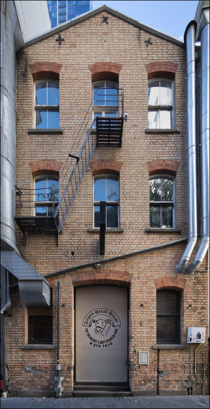
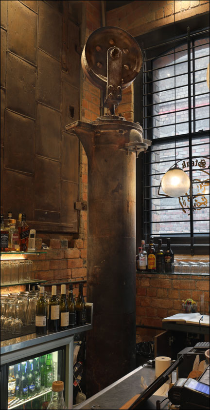
Below: One of the buildings in Fort Lane whose form is recognisably from the era of the Graphic's pictures is seen at left, on the lane's eastern side. It currently (2025) houses a restaurant whose interior (right) preserves some features—including the mysterious machine at centre—of its industrial past.
 |
 |
A stroll along Fort Lane: east side
Below is a movie (duration 02m:13s) of a scrolling strip panorama of the eastern side of the lane as it is in 2025, beginning at the Fort Street end.
A stroll along Fort Lane: west side
Below is a movie (duration 02m:12s) of a scrolling strip panorama of the western side of the lane as it is in 2025, beginning at the Customs Street end.