Looking east from Morton Street along Baker Street
1928 (James Richardson) - 2024
Click on image to toggle transition between two photographs
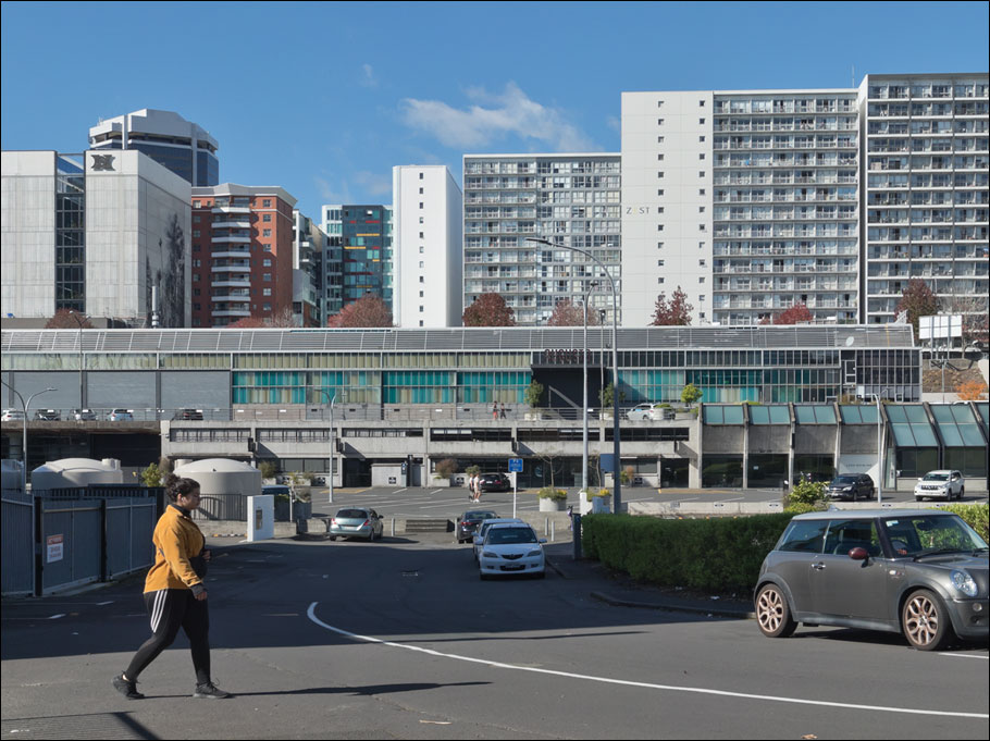
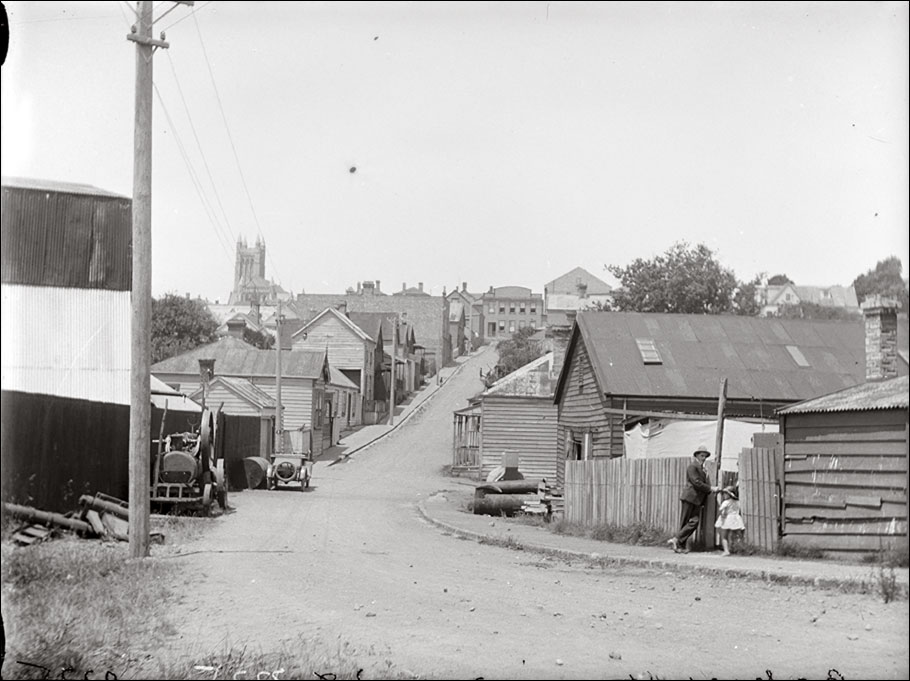
1928 image: James D Richardson | Auckland Libraries Heritage Collections
Image comparison slider version
Click here for a fullscreen version of this transition and here for a short animation of these images.
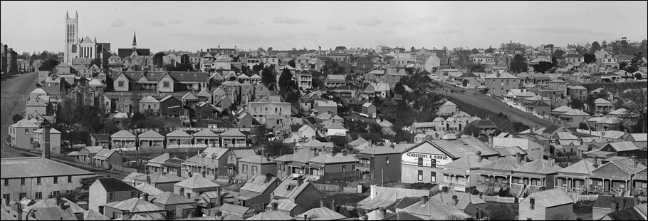
This neighborhood on the western slopes of the Hobson Street ridge running down from Nelson Street to Freemans Bay no longer exists. In its place is the sprawling Auckland City Council Works Depot constructed in the 1960s (itself now defunct and repurposed, much of it a carpark). So thoroughgoing was the obliteration of the streets and houses here that even the topography of the land was modified, with the natural slope being replaced by retaining walls and terraces.
Below: Looking west from Nelson Street down Baker Street, 1928.
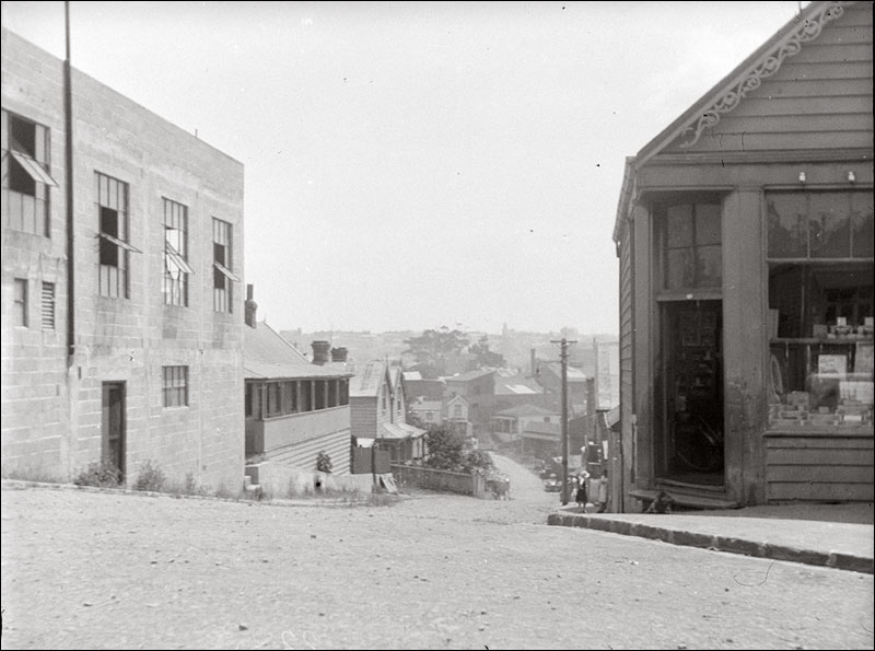
1928 image: James D Richardson | Auckland Libraries Heritage Collections
Below: Looking along Monowai Street from Baker Street, 1928. The entrance to Monowai Street is visible in the main Baker Street image (at the top of this page) below centre.
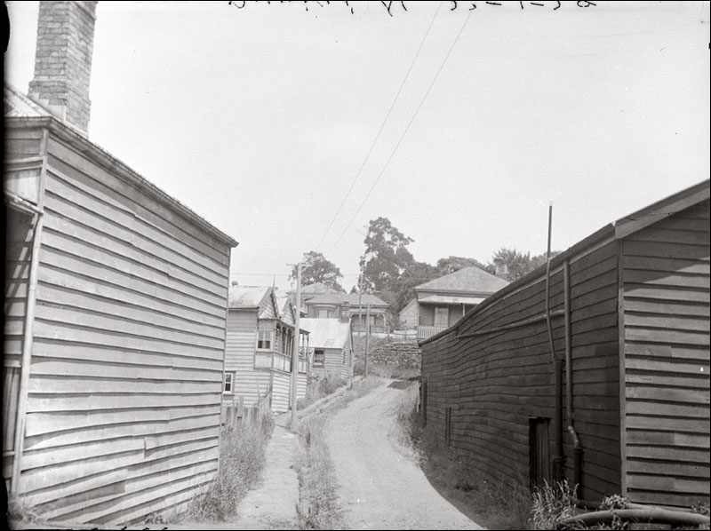
1928 image: James D Richardson | Auckland Libraries Heritage Collections
Below: Looking west during the construction of the Auckland City Council Works Depot, 1965. The camera position for the Baker Street picture is in the vicinity of the trees at far right.
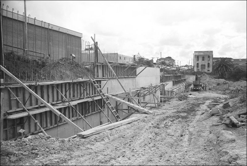
1965 image: Probably Ernest Ian MacLaren | Auckland Libraries Heritage Collections 580-11690
Below: An aerial photograph of the construction site for the Auckland City Council works depot, taken by Whites Aviation in 1965. Click on image to toggle an overlay showing the approximate location of Baker Street (along with Monowai, Malta, Patea and MacKellar Streets).
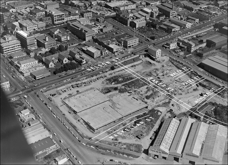
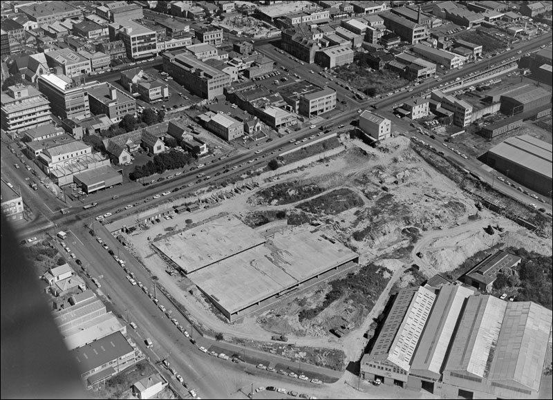
1965 image: Construction site of City Council works depot, Nelson Street, Auckland City. Whites Aviation Ltd: Photographs. Ref: WA-63321-G. Alexander Turnbull Library, Wellington, New Zealand. /records/22883743
Below: Looking east across this neighborhood in 1905; a detail from a superb Henry Winkelmann panorama (made from the city destructor). Click on image for a larger version.
Auckland Libraries Heritage Collections 1-W1245, 1-W1246 (detail)
Below: a few more examples of Richardson's 1928 documentation of this neighborhood.
Looking north from Cook Street showing houses in Malta Street.
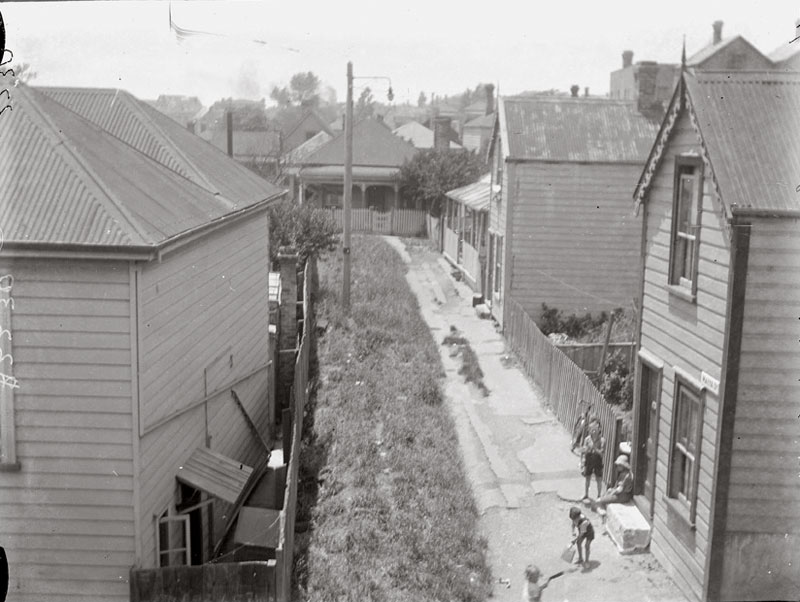
1928 image: James D Richardson | Auckland Libraries Heritage Collections
Below: Looking north from Cook Street along Patea Street.
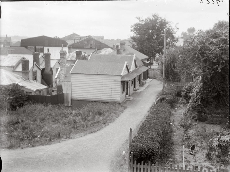
1928 image: James D Richardson | Auckland Libraries Heritage Collections
Below: Looking east along Cook Street from the vicinity of Patea Street.

1928 image: James D Richardson | Auckland Libraries Heritage Collections
Below: Looking south-west from Wellesley Street West along MacKellar Street.
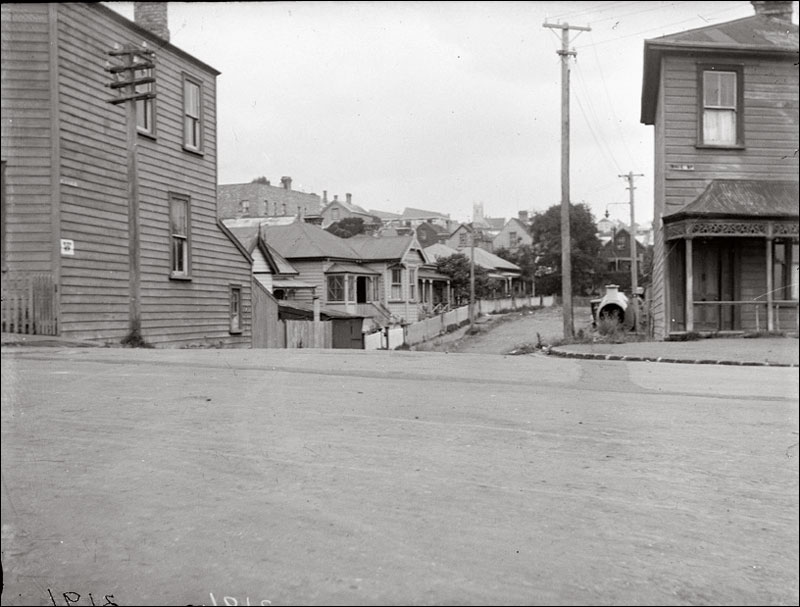
1928 image: James D Richardson | Auckland Libraries Heritage Collections
