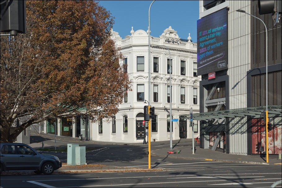
Looking south along old Customs Street West, Freemans Bay
1912 (Henry Winkelmann) - 2022
Click on image to toggle transition between two photographs
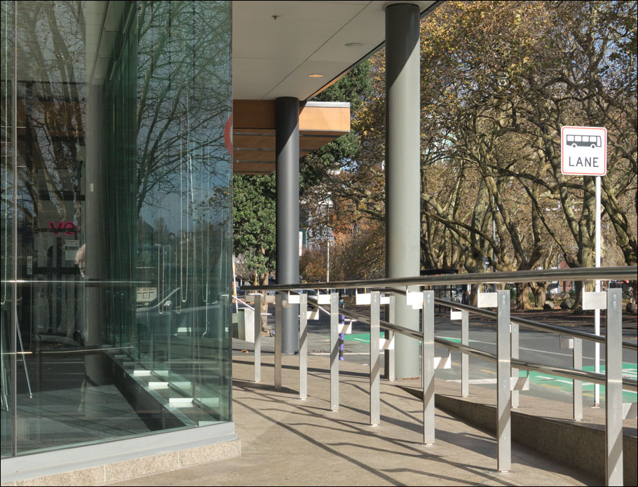
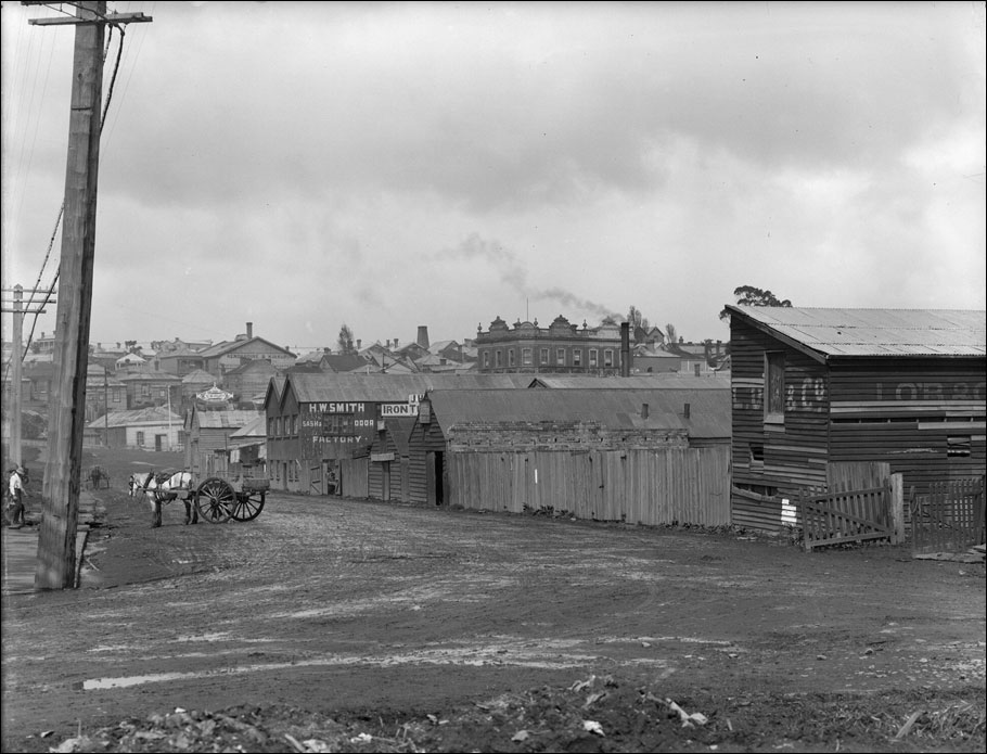
1912 image: Henry Winkelmann | Auckland Libraries Heritage Collections 1-W0881
This section of old Customs Street West leading into Freeman's Bay is long since vanished, (modern Halsey Street is only roughly equivalent, if at all) and this makes for enough uncertainty about Winkelmann's exact camera position in 1912 to make this comparison only an approximation.
The prominent building at centre in the 1912 image is Freeman's Hotel, still present though hard to make out through the trees and other clutter in the modern scene. Winkelmann recorded this view in his index ledger as ‘Customs St W old buildings to be demolished’. The buildings backed on to the eastern side of Victoria Park, occupying, it seems, much of present-day Halsey Street.
I think that Winkelmann's position in 1912 would have been somewhat to the left of that shown by my 2022 image here, probably somewhere inside the modern building seen here (which occupies the corner of present-day Fanshawe and Halsey Streets). Perspective and parallax clues in the appearance of Freeman's Hotel seem to confirm this; the east (left) side of the hotel is seen at too-acute an angle here.
Below is another photograph taken by Winkelmann on the same day (23 September 1912) looking west from high ground above Customs Street West (in the vicinity perhaps of Hardinge Street) showing the ongoing reclamation of Freeman's Bay. The circle indicates what I think must be his camera position (pointing to the left here) for the then-and-now image above. (One longs for a Winkelmann panorama here.)
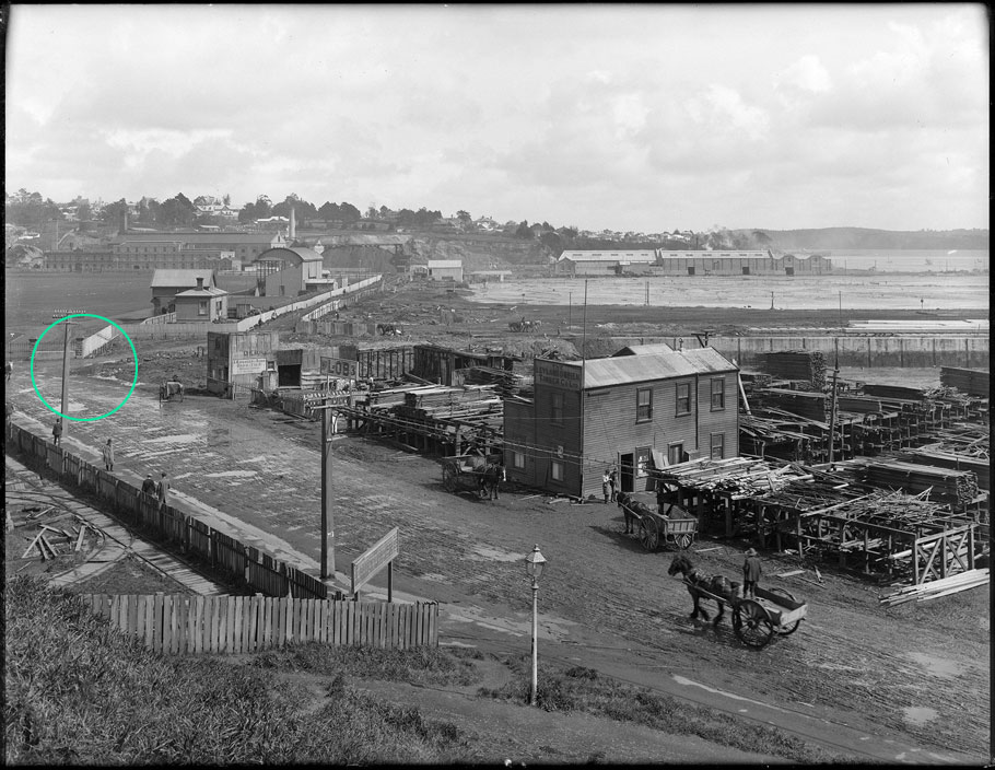
Auckland Libraries Heritage Collections 1-W0961
Below is a detail of an earlier (1905) Winkelmann image looking north-east from the chimney of the City Destructor and thus looking at the backs of the row of buildings in the 1912 image. The circle indicates the approximate location of what I assume to be Winkelmann's 1912 camera position, in the vicinity of the leaning power pole. Note the dogleg in Customs Street West leading back toward the city centre; this dip southward would later be straightened out when Fanshawe Street as we know it today was formed. It's also evident in W0961 above.
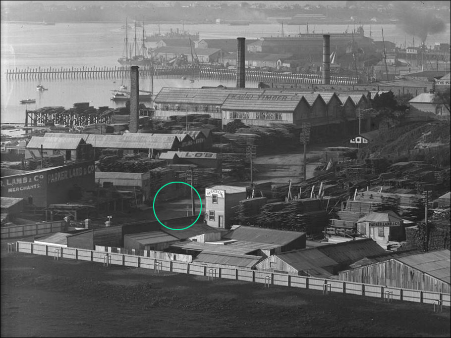
Auckland Libraries Heritage Collections 1-W0999 (detail)
Incidentally, the image above is one plate from an overlapping series which together form a superb panorama; it can be viewed in all its glory on Auckland Council's Kura Heritage Collections Online site at this link:
kura.aucklandlibraries.govt.nz/digital/collection/photos/id/107387/rec/6
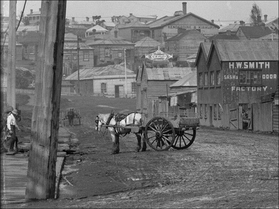
Below, a detail from Winkelmann's 1912 image. The slope of Victoria Street West is visible at the far end of the street.
Below, a recent picture of the old Freeman's Hotel, taken from about the same angle as in Winkelmann's image, though obviously much closer.
