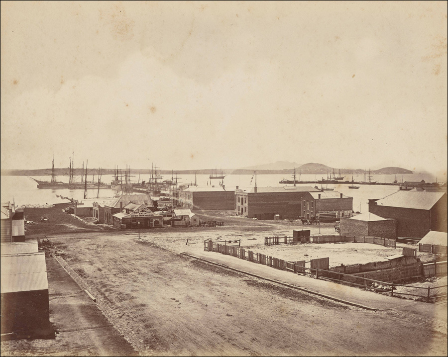
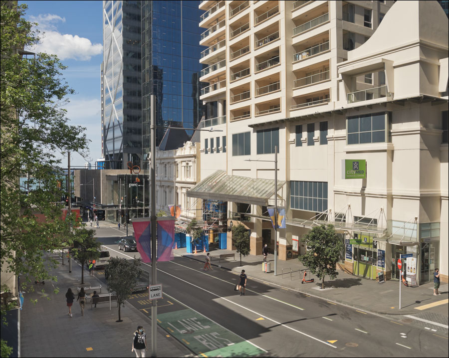
Looking north-east down Albert Street
1880s, by Herbert Deveril [attributed] – 2021
Drag the slider to compare two photographs
|
1880s image: Auckland Harbour from Albert Street, Herbert Deveril [attributed] | Auckland Libraries Heritage Collections 1746-05
This area around lower Albert Street and the now vanished Point Stanley (later known as Smale's Point) to the west of Commercial Bay seems to have been a spot much favoured by 19th century photographers. There appears to have been high ground immediately to the west of Albert Street in this area, which photographers would have naturally taken advantage of. Below are a few images of this part of old Auckland—roughly similar views from roughly the same place—as it evolved.
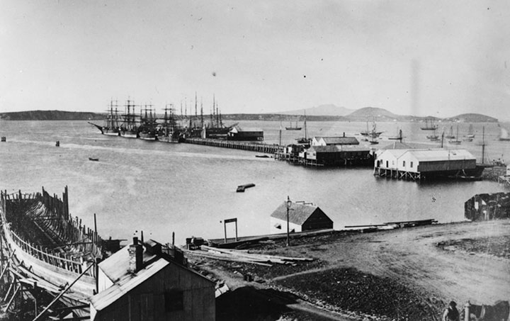
The area in 1866. Looking toward Queen Street Wharf, with a ship building yard at left and the junction of Custom House Street (Customs Street) and Albert Street right of centre.
Copy by James Richardson of a photograph by an unknown photographer | Auckland Libraries Heritage Collections 4-1005
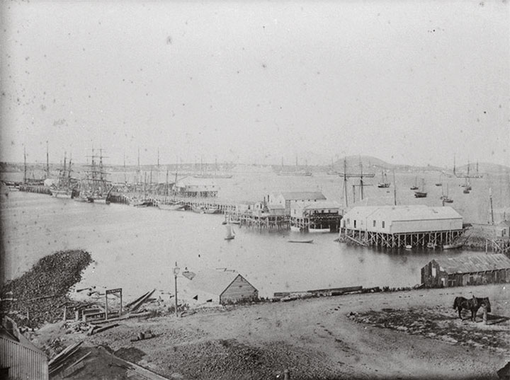
A similar view from circa 1869.
Copy by James Richardson of a photograph by an unknown photographer | Auckland Libraries Heritage Collections 4-519
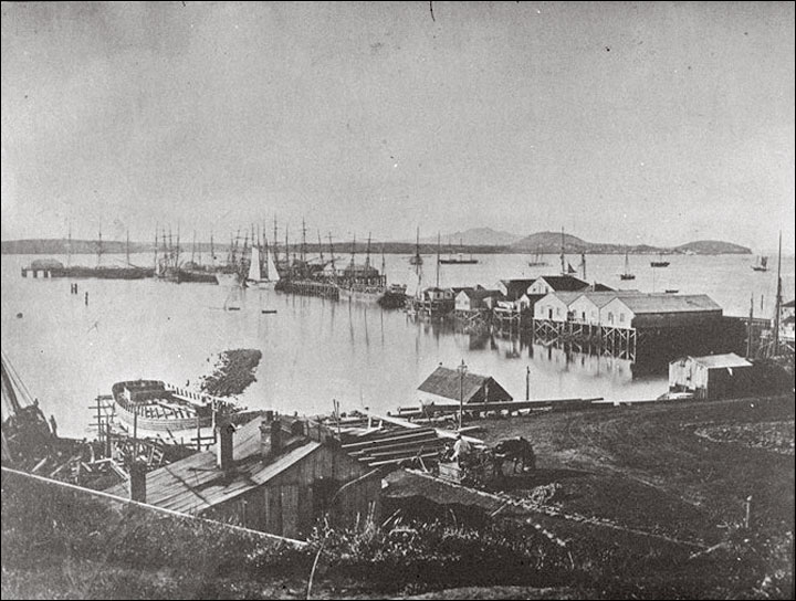
A little later, in the early 1870s, not much has changed other than the appearance of additional structures on the wharf.
Copy by James Richardson of a photograph by an unknown photographer | Auckland Libraries Heritage Collections 4-518

Late 1870s. Reclamation is advancing to the west of Queen Street. Railway Wharf appears at right.
Copy by James Richardson of a photograph by an unknown photographer | Auckland Libraries Heritage Collections 4-574
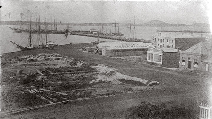
Dated 1880. Customs Street in foreground. The scene now resembles the Herbert Deveril image at top.
Copy by James Richardson of a photograph by H A Frith | Auckland Libraries Heritage Collections 4-569